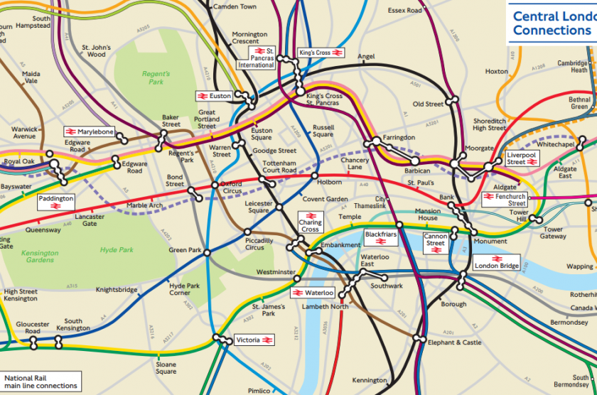
By complete chance I stumbled across this little treasure: a geographical map of London’s tube and rail networks. Whilst TFL have been kind enough to produce this (be it outdated back to April / May 2014 and with a few minor errors), they haven’t actually bothered to tell anyone about it.
Poor visitors to London have been stuck solely with the standard tube map that is primed to deceive. It is undeniable that this map can boast how it has made navigating an otherwise complicated interconnected network of different lines and services relatively simple and clear. However, for the unsuspecting newcomer who knows no better, endless time can be wasted trying to stalk a tube line by foot from station to station overground in the hope of ending up at their desired destination. Tales of woe and regret surround this innocent mistake!
Lucky for us all now, there is no more need to follow tube lines to walk through the city with the abundance of maps at every other street corner and more importantly the attached-at-your-hip smartphone with GPS. However, it would still be nice to have a published version of this to make life that little bit easier- I mean what harm would it do?!
Thank you Mapping London and City Metric for this nugget of gold!

Leave a comment